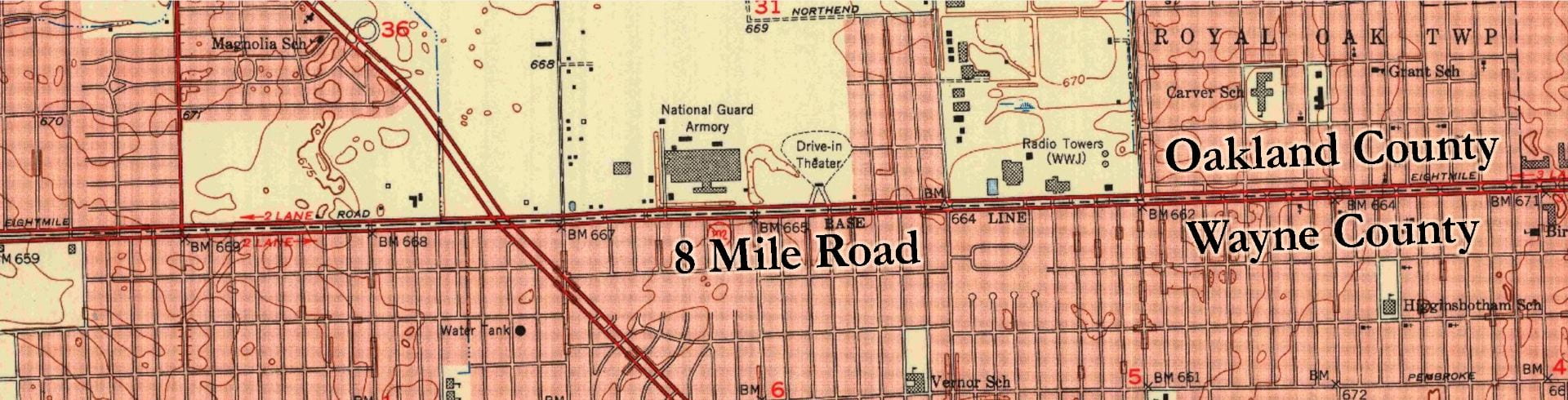
8 Mile Road in 1952, Detroit’s northern border (from USGS map)
“The three biggest [Detroit suburbs] – Livonia, Dearborn and Warren – were home to over 400,000 residents [in 1970, two years after the passage of the Fair Housing Act]. Only 186 were black.”
– Reynolds Farley et al., Detroit Divided (2000).
After the civil rights movement and Detroit’s 1967 civil unrest, White fears of Black violence accelerated White flight to the suburbs. At one time, Detroit’s small population of Blacks was confined to a few neighborhoods. Blacks were contained, and Detroit remained a majority-White city. But as more Blacks arrived and as more Whites fled, the color lines expanded out from the inner city. Starting at Paradise Valley, the color line expanded north past the perimeter roads that marked the distance from Downtown Detroit like milestones, past six, seven, and then Eight Mile Road.
However, the color lines stopped moving in the 1980s at the northern city limits of Detroit: Eight Mile Road. The Black population edged up against Eight Mile Road, as they had edged up and overcome earlier barriers to their movement to the suburbs. Yet, this newest barrier proved to be the strongest yet. Many suburbs to the north remained 90% White, while the city to the south became 90% Black. A new color line had emerged, not within Detroit but at the city edge.
Some color lines are imaginary and reflect where people wish they could create barriers. Others are real. The color lines drawn on the 1940s redlining maps represent where government wanted Black people to stay. Other barriers like “restrictive covenants” prevented White families from selling to Blacks wanting to move into their all-White neighborhoods. But these barriers were overcome, either through new laws that made redlining illegal or through activism in the Black community. The barrier of Eight Mile Road was not.
As Martin Luther King put described in his 1968 speech in the all-White suburb of Grosse Pointe: “There are literally two Americas. Every city in our country has this kind of dualism, this schizophrenia, split at so many parts, and so every city ends up being two cities rather than one.”
This chapter explores the city limits of Detroit as a color line. Maps illustrate the racial, economic, and public health inequalities that exist just a few streets away from each other. This chapter also explores municipal borders and school districts as new forms of legalized segregation, drawn in such a way as to divide suburb from city, wealth from poverty, and White from Black. Of particular interest is the case study of Royal Oak Township, the only all-Black suburb on the suburban side of Eight Mile Road.
This chapter is still under construction.
See story map in Chapter 1 for work sample of what this chapter could become.